
A New Picture of Segregation
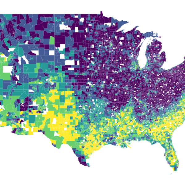
Traditional measures of segregation rely on where people live, but daily life extends far beyond the home. This project visualizes the National Experienced Racial-Ethnic Diversity (NERD) dataset, measuring diversity people encounter at work, during errands, and in leisure activities. Using anonymized mobile phone location data from over 66 million opted-in devices, we provide estimates of experienced diversity for the entire United States at the census tract level.
Explore the interactive maps and data at newpicture.urbandataresearchlab.org.
Publications
An experienced racial-ethnic diversity dataset in the United States using human mobility data
Xu, W., Wang, Z., Attia, N., Attia, Y., Zhang, Y., Zong, H.
Scientific Data, 11(1), 638, 2024
Despite the importance of measuring racial-ethnic segregation and diversity in the United States, current measurements are largely based on the Census and, thus, only reflect segregation and diversity as understood through residential location. This leaves out the social contexts experienced throughout the course of the day during work, leisure, errands, and other activities.
The National Experienced Racial-ethnic Diversity (NERD) dataset provides estimates of diversity for the entire United States at the census tract level based on the range of place and times when people have the opportunity to come into contact with one another. Using anonymized and opted-in mobile phone location data to determine co-locations of people and their demographic backgrounds, these measurements of diversity in potential social interactions are estimated at 38.2m × 19.1m scale and 15-minute timeframe for a representative year and aggregated to the Census tract level for purposes of data privacy.
As well, we detail some of the characteristics and limitations of the data for potential use in national, comparative studies.
https://doi.org/10.1038/s41597-024-03490-yThe Where, When, and How of Diversity: How Space, Time, and Incomes Configure the Racial-Ethnic Composition of Networks
Xu, W.
Annals of the American Association of Geographers, 114(8), 2024
This article investigates the relationship between income and the diversity of sociospatial networks as described by high-density mobile phone application (MPA) Global Positioning System data.
Looking at the counties that contain the Atlanta, Boston, Chicago, and Los Angeles metropolitan regions in August and September 2022, this study asks the following questions: How does the racial-ethnic diversity and spatial extent of network of activity space-times — the place and time of daily activities — vary across different income levels? Given the existing literature, are more diverse networks composed of higher income classes? Are there key types of activity space-times that are more likely to be in these networks?
Given that the overlap of activity spaces might lead to the formation of stronger social ties, this study aims to provide new evidence of the role of activity spaces in determining the diversity of social exposures with high-resolution spatiotemporal MPA activity.
Results suggest that income is an important determinant of diversity in networks, with the highest and lowest income groups both exhibiting the least diversity in networks, whereas institutional spaces like church or school and other surprising places such as the dentist's office are the most likely activity space-times in these networks.
https://doi.org/10.1080/24694452.2024.2339443The contingency of neighbourhood diversity: Variation of social context using mobile phone application data
Xu, W.
Urban Studies, 59(4), 851–869, 2022
This research uses high-density anonymised mobile phone application (MPA) global-positioning system (GPS) data to describe exposure to racial diversity in different social contexts with an aim to clarify the mechanism linking residential diversity to opportunities for diverse social interactions.
In particular, it explores the hypothesis that a diverse residential context does not lead to diverse social contact by comparing three exposure measures — residential, observed and interaction — on the census block group level in Chicago. In doing so, it also explores the contribution of activity spaces to opportunities for diverse social contact.
The findings show that the exposure to opportunities for diverse social contact measured by MPA data is generally higher than what is implied by residential census data, especially in areas of high residential segregation in the city. Further, measures using MPA data reveal more spatiotemporal heterogeneity of exposure than that implied by the residential context.
https://doi.org/10.1177/00420980211019637https://github.com/iamwfx/cell_data_diversityIn the Media
- Block Club Chicago — PNAS traffic citations paper, 2024
- Chicago Tribune — PNAS traffic citations paper, 2024
- NBC Chicago — PNAS traffic citations paper, 2024
- Cornell Chronicle — PNAS traffic citations paper, 2024